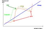
The phenomenon of altitudinal zonality
The presence of mountains is one of the main reasons for breaking the law geographic zoning and the formation of azonal natural complexes. With magnification absolute height average daily decrease and, accordingly average annual temperatures, indicators are decreasing atmospheric pressure... Climatic indicators affect the formation of soils. The combination of these factors affects the development of natural complexes. Differences are also formed depending on the direction of the slope (insolation).
Definition 1
The change in natural complexes with height is called altitudinal zonality .
On the territory of Russia there are Ural Mountains, North Caucasus, mountain structures of the South of Siberia .
## Altitude zonality Ural mountains
Ural mountains stretched into submeridional direction for almost $ 2000 $ km and serve as a conditional border between Europe and Asia. The highest point of the Urals - mountain Narodnaya ($ 1894 $ m). The average heights of the Ural Mountains do not exceed $ 1000 m. Therefore, the Ural belongs to low mountains.
Due to the peculiarities geographic location, natural complexes the western and eastern slopes differ from each other. Due to the western transport of air masses, the western slopes of the mountains are more humid and warm, and the eastern ones are drier and colder. In general, the natural zones of the Urals correspond to latitudinal ones, but are somewhat "shifted" to the south. The territory of the Ural Mountains is crossed natural areas temperate zone from tundra to semi-desert.
Altitudinal zonation of the North Caucasus
Greater Caucasian the ridge stretches from northwest to southeast, rising to a height of $ 5000 m in large folds. The highest points of the Main Caucasian ridge - Elbrus ($ 5642 m) and Kazbek ($ 5033 m).
Remark 1
Elbrus is the highest point in Russia.
The Caucasus as a mountain structure is located on the border of the temperate and subtropical climatic zones and serves as a barrier to the cold northern air. In the southwestern part of the mountains falls from $ 2600 to $ 4000 $ mm of precipitation per year. Here formed humid subtropics ... And on the southeastern slopes formed dry subtropics .
The mountain tops are covered perennial snows and glaciers ... Below, up to a height of $ 2000 $ m, there is a belt alpine and subalpine meadows ... Even lower, up to a height of $ 1300 m, grow spruce-fir forests, changing to the bottom oak forests ... There are thickets at the foot evergreen shrubs and vines , and in arid places - thorny shrubs (shiblyak) .
Altitudinal zonation of the mountains of the South of Siberia
The mountain belt of southern Siberia stretches from Altai in the west to mountain systems Transbaikalia in the east of the country. Altai is the most high mountains this system ( Mount Belukha ($ 4506 m) - the most high point Siberia). Along the slopes of Altai up to an altitude of $ 500 m in the north and $ 1500 m in the south steppe ... Above the steppes on the damp western slopes of Altai there are spruce-fir forests ... On the territory of the Eastern and Western Sayans, the Baikal Mountains and in the mountains of Transbaikalia, prevail light coniferous pine-larch forests on mountain-taiga permafrost soils. The mountain tops are covered shrub thickets of cedar dwarf ... Above the forests in Altai there are subalpine and alpine meadows , and in dry conditions of the Sayan Mountains, on the Baikal and Aldan highlands, mountain areas are covered mountain tundra with dwarf birch ... Complexes are formed on the southern slopes dry Mongolian steppes .
Since there are no higher mountain systems on the territory of Russia, the areas of altitudinal zonality do not play very much big role in nature. And the mountain steppes are undergoing significant changes due to economic activity person. Most of them are plowed up, and the rest of the territory is used as hayfields and mountain pastures. Logging is carried out on the forest slopes.
Remark 2
Mountain structures of North-Eastern Siberia are of insignificant height. Moreover, they are located in the tundra zone. Therefore, the altitudinal zonation in northeastern Russia is not clearly expressed.
To the question Comparative characteristics types of altitudinal zonation of Altai grade 8 Geography given by the author Den den the best answer is The change with the height of heat resources and moisture supply is the most important reason altitude zoning landscapes in the mountains and vertical zonation of soil vegetation.
The structure of altitudinal zoning, i.e. the set of altitude zones and the sequence of their changes depends on the position mountainous area in the latitudinal landscape zone and in a certain ratio with the paths of moisture air masses, and their number is due to the height of the mountains and the exposure of the slopes. So, in low mountains Kuznetsk-Salair region, located in the forest-steppe zone and sub-zone southern taiga, mountain-forest landscapes dominate and alpine landscapes are only very fragmentarily developed, in the higher massifs of the East Sayan province there are much more high-altitude zones.
The nature of high-altitude zoning largely depends on the moisture conditions. Due to this in the mountains Southern Siberia BF Petrov (1952) distinguishes between "cyclonic" and "continental" variants of zoning.
From the west, cyclones approach Altai and Kuznetsk Alatau, carrying Atlantic air, transformed over the continent (heated). Semi-extinct cyclones come to life on the slopes of the leading ridges, resulting in increased cloudiness and increased precipitation. The areas of the Eastern Sayan and Northern Transbaikalia are influenced by the Arctic air, which results in a decrease in air temperature and a decrease in precipitation.
The gradual change of one landscape zone to another and the formation of a kind of transitional "subzones" in the cyclonic provinces of the mountains of Southern Siberia (Western and Northeastern Altai, Kuznetsk-Salair region, Western Sayan) is associated with low temperature gradients (0.3-0.40) in these areas in summer, i.e., with a gradual change in hydrothermal conditions, ensuring the development of mesophilic variants of steppe and forest vegetation.
Rice. 2. Scheme of altitude zoning of Western Altai (A) and Eastern Sayan (B
Therefore, all mountain zones of these provinces are characterized by a significant vertical width and an indistinct nature of the boundaries (Fig. 2, A). In the continental regions and provinces (Eastern Sayan, Tuva, Eastern Altai), where the temperature gradients in the warm season are more significant (0.7–0.80), zone changes occur quickly, their boundaries are more distinct, and there are no transitional subzones. The structure of these zones is dominated by "xerophilic" variants of the vegetation cover, which are often observed on the slopes of the eastern exposures of large ridges in the "rain" shadow (Fig. 2, B).
Comparing these types of zoning, it can be seen that in the continental province of the Eastern Sayan (see Fig. 2. B) there are no meadow steppes characteristic of Western Altai (see Fig. 2, A), and alpine and subalpine meadows are found only in the southern slope. There is no clearly defined sub-zone of subalpine woodlands, and stony and rubble-lichen predominate among the tundras.
Students at seminars, using cartographic and literary material, should draw up complex profiles for cyclonic and continental provinces (through the North-Eastern Altai, Kuznetsk Alatau, Eastern Tuva, etc.), and then analyze the resulting schemes.
A completely different character of zoning is characteristic of the southern regions of the mountains of South Siberia: South-East Altai and South Tuva (Fig. 3).
Rice. 3. Scheme of high-altitude zoning of South-Eastern Altai:
Here, on the slopes of mountain ranges, there is no longer a continuous forest zone and small sod-grass or shrub dry mountain steppes pass directly into the tundra, creating a kind of strip of tundra-steppe landscapes, often confined to areas of accumulation of glacial Pleistocene sediments, where in conditions of hilly relief, hilly terrain edaphic conditions for the formation of steppe (often cryophytic) and typically tundra complexes.

Altitude zonation in the Altai mountains 1. Altai mountains Spacecraft: Landsat Spatial resolution (original): 28.5 m Geographic center of the image: 51 ° 20 N, 87 ° 29 E Spectral channels: 2, 4, 7 Device: ETM + Date: August 17, 2001 Additional description: The image was synthesized in pseudo colors and reduced to a spatial resolution of 456 m. A fragment of Gorny Altai in the territory of the Altai Republic in the area of Lake Teletskoye is shown. Black color - mountain lakes... Black and red (threadlike objects) - riverbeds. Pale yellow-green color - vegetation of steppes and forest-steppes. Pale green tones - deciduous vegetation (forests, shrubs). Green, dark green and blue-green shades- dark conifers, conifers and mixed forests(taiga zone). Bright green tones (closer to the tops of the mountains) - alpine meadows. Yellow tones - mountain tundra. Lilac and purple shades are rocky deserts. White color- heap clouds. Source: Table of Contents Image Technological parameters Images

Altitude zonation in the Altai Mountains Brief thematic description The resource represents the region Mountain Altai in the area of Lake Teletskoye. Remote sensing data allow one to see in one image almost the entire range of altitudinal zonality in the Altai mountains, from forest-steppe and steppes to mountain tundra and loach. Table of contents Design, layout Design, layout -

The climatic conditions of the province are not the same in different altitude zones and belts. In the middle and high mountains, the climate is rather humid. Average January temperatures -17, -20 0 С, at the bottom river valleys on some days frosts reach -50, -55 0. Summer at the bottom altitude zone relatively long and warm. The sum of temperatures above 10 0 is here 2100 - 2300 0, the duration of the period with these temperatures is 130 - 140 days. Average temperature in July 20, 21 0, maximum temperatures exceed 40 0. Annual quantity precipitation in low foothills in the west of the province up to 450mm. In the mountains average temperature July drops to 10 - 12 0, and the amount of precipitation increases greatly, in the upper reaches of the Uba and Ulba reaches 1500 - 2000 mm per year. The maximum precipitation occurs during the warm period. Compared to other parts of Altai, the West Altai province is distinguished by a significant snowiness of winter and a thick snow cover... Nevertheless, on the ridge of mountains rising above 2200 - 2300m, it is common permafrost... There are modern glaciers on the Kholzun and Ivanovsky ridges.
The main rivers flowing through the province are the Irtysh and its right tributaries Bukhtarma, Ulba, Uba. The Irtysh runoff is regulated by dams located on the territory of the province of large hydroelectric power plants - Ust-Kamenogorsk, Bukhtarma. The rest of the rivers, starting in the mountains within the Altai region, are of the Altai type according to the regime. The rivers are fed mixed due to the melting of seasonal snow and summer rains, and only at Bukhtarma is the role of glacial nutrition significant. The wood is rafted along the rivers. Can be used for hydropower purposes. There are many picturesque freshwater lakes in the province.
V soil cover in the western, Irtysh, part of the province, dark chestnut soils, chernozems and mountain chernozems are widespread, and the chernozem soils are not very humus-rich (medium- and low-humus), but very thick. Through leached chernozems, they go higher into gray forest soils(under small-leaved forests), characterized by high thickness and deep leaching. Mountain forests are characterized by mountain forest acidic non-podzolized and weakly podzolized soils. Acidic mountain meadow subalpine, partly alpine soils and mountain tundra gleyed and non-gleyed soils are widespread in the highlands.
There are three high-altitude landscape zones in the province: mountain-steppe (up to about 900m abs. Height), mountain-forest (up to 1800-1900m) and alpine, mainly mountain-meadow, partly mountain-tundra with cryophilic-shrub vegetation. Shrub steppes - rose gardens are widespread in the mountain-steppe zone. The mountain-forest zone is characterized by black (cedar-spruce-fir) forests, which are replaced by larch forests in the east. The high-mountain tundra is dominated by moss-birch lichen-dryad associations.
The climate of the foothills of the Southern Altai and the valley of the Bukhtarma River is the warmest of all Altai regions. By southern border on the slope of the Zaisan depression, the sum of temperatures above 10 0 is 2400 0, and the duration of the period with these temperatures reaches 150 days. Average July temperatures are 20 - 22 0, January - 17, - 20 0, absolute maximums and minimums 40 - 42 0, - 45 - 54 0. In the mountains, the average July temperatures drop to 7-10 0. The distribution of precipitation over the territory of the province is uneven, from 200 mm per year in the southern foothills to 700 mm in the mountains. The maximum precipitation occurs during the warm season. The thickness of the snow cover in the foothills is insignificant (20-30 cm), in the mountains it increases. Permafrost is widespread on the ridges above 2000 - 2500 m. Because of great height mountains in the province are developed modern glaciation... There are glaciers on the Katunsky ridge at the head of the river. Bereli, on the ridges of the Southern Altai, Sarymsakty, etc.
In the arid steppes of the foothills, mountain chestnut soils dominate, giving way to mountain chernozems on the northern slopes of the mountains, and higher - to mountain-forest acidic crypto-podzolic, mountain-forest chernozem-like, non-podzolized soils and dark mountain soddy soils of forest meadows. On the southern slopes falls forest zone, being replaced by a forest-meadow belt with a forest-steppe zone, and mountain-forest soils are less widespread, and chernozems steppe zone give way to mountain-steppe xeromorphic leached soils. In the highlands of the eastern part of the province, mountain-tundra peaty gleyed and non-gleyed soils are widespread, as well as mountain meadow soils, usually also peaty or coarse-humus. Significant acidity of alpine soils is characteristic.
Due to the great dryness of the climate, the mountain steppes on Southern Altai rise higher than in the previous province, especially on the southern slopes of the ridges (up to 1200 - 1500m). In the middle mountains (from 1300 to 1800 m, in the east - higher) common coniferous forests alternating with cereal-forb meadows. Forests grow mainly on the northern slopes, while the southern ones are dominated by meadows and shrubs. The forests are dominated by larch, sometimes found Siberian fir, in the form of an admixture to larch or forms pure plantings. The high-altitude zone is characterized by barren sedge meadows, cuff and cobresia wastelands, moss-shrub and moss-lichen stony tundras, as well as bare rocks and stony taluses. The glacial-nival zone is developed on the highest ridges (with heights of 2300-3000m on the northern slopes and 2500-3200m on the southern). The province's landscapes are influenced by deserts Central Asia and semi-deserts of Central Kazakhstan: there are many Central Asian species in the flora and fauna.